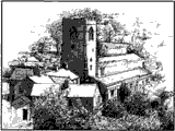
Malham Moor
MALHAM-MOOR, a township in that part of the parish of KIRKBY in MALHAM-DALE which is in the western division of the wapentake of STAINCLIFFE and EWCROSS, West riding of the county of YORK, 5.5 miles (N.E.) from Settle, containing 88 inhabitants.
Samuel Lewis “Topographical Dictionary of England” 1831
Malham Moor is a civil parish in the Craven district of North Yorkshire, England. Its population was estimated at 70 in 2015.[1] It has a joint parish council, Kirkby Malhamdale Parish Council, with the parishes of Malham, Kirkby Malham and Hanlith.[2]
.jpg)
There is no village in the parish. The parish includes scattered farms and houses, Malham Tarn and large areas of moorland, including Fountains Fell. The upland area identified on Ordnance Survey maps as Malham Moor lies outside the parish, to the east. It is north west of Threshfield along Malham Moor Lane. Its summit is at 411m.(SD952648) Malham Moor was historically a township in the ancient parish of Kirkby Malham in the West Riding of Yorkshire.[3] It became a civil parish in 1866,[4] and in 1974 was transferred to the new county of North Yorkshire. (Wikipedia 2024)
Editor’s note:
The only real way to understand this fairly remote and windswept plateau, is to walk or drive up onto Malham Moor and observe the landscape. The history of this moor is perhaps more closely tied to its physical geography than perhaps the valley townships and the farming, mining and trading that have taken place are very particular to its elevation, exposure and geology.
Do please be aware if visiting that temperatures and windchill can quickly become severe, however there is reasonable mobile phone reception on EE and O2 networks.
| Maps & Topography | |
| Modern OS map: Showing the area around the Tarn Jefferys map : 1771 – 1 inch to 1 mile Scheduled monuments in Malhamdale : Overlaid map from the Government’s countryside GIS mapping service, MAGIC.Malham Moor – 1850 (direct link no longer available): By John Greenwood 1850, a draft plan showing field names and owners, from the Arthur Raistrick Map Collection at The JB Priestley Library, Bradford University. This is one of 1200 maps in the Raistrick archive and may not be available online. Please paste link below into a new tab in your browser.archiveshub.jisc.ac.uk/search/archives/b204d4e3-3a8a-3045-b845-fb97dc2c9d88Malham Enclosure Award Map: Full transcript of the award with map.Parish map: Showing Kirkby Malhamdale and the townships and the old Ecclesiastical parishes surrounding it. |
|
| People & Families | |
| Census:1841 Census Malham Moor:HO107/1321/5 fo.4-5b1851 Census Malham Moor:HO107 / 2277 fo.489b-491b
:RG9 / 3180 fo.4-6a :RG10/4257 fo. 7b-10b :RG11 / 4300 fo.1-3b
|
|
| Land, Tax, Probate etc. Malham Moor Tenants : Tenants of Thomas Lister/’Lord Ribblesdale’ in 1760, 1786 and 1823 Land Tax Assessment 1798 : Listing landowners and occupiers. Land Tax Assessment 1803 : Listing landowners and occupiers Return of Owners of Land 1873 : Land held in the West Riding of Yorkshire by Malhamdale residents. Land Tax Assessment 1916 : A listing of the occupiers of Malham Moor in 1915/16 and the rateable value for the properties – from a paper scrap held in the archives! Memorials of the Abbey of St Mary of Fountains Vol.1 : PDF copy of the book published by the Surtees Society in 1863 which includes many mentions of the lands held by the Abbey in Malhamdale. You can also find fully searchable PDF versions of Vol.2 and Vol. 3 . Wills – Henry & Mathew Knowles – 1689 : Records of the monastery’s stock held at farms on Malham Moor and elsewhere. Written in latin with some translations it is part of the Bradfer-Lawrence collection at the YAS.
|
|
| Genealogy & Biography
Procter of Malham Moor: Brief details about the Procter family of Bordley and Malham Moor.
: Details of the ruin of Great Close House, close to Malham Tarn Links previously here in original MLHG website were duplicated and are still to be found on the Malhamdale in General page.
|
|
| Buildings & Places | |
Listed Buildings in Malhamdale Where to find details of listings and surveys. Malham Water House sale brochure 1850, (includes all other lands/lots for sale) Please paste link directly into new tab in your web browser. http://www.bl.yascollections.org.uk/index.php?secid=02&id=891 : Also from the Bradfer-Lawrence collection at the YAS. To see all nine pages at a legible size, click the icon in the brown horizontal bar just below the thumbnail image
Bolton Priory Sheephouse : Priory Raikes : Details from the National Park’s Out Of Oblivion website. Archaeology of Malham Moor Please paste link directly into new tab in your web browser. http://www.field-studies-council.org/resources/field-studies-journal/archaeology-of-malham-moor/ : Field Studies Council paper by Arthur Raistrick & Paul F Holmes, with drawings of excavations and finds. : Details from the National Park’s Out Of Oblivion website. : Details from the National Park’s Out Of Oblivion website. Malham Moor Folly : A sketch of the proposed building on Hawke Scar, dated 1789. From the Ribblesdale papers in the Bradfer-Lawrence collection at the YAS. http://www.bl.yascollections.org.uk/index.php?secid=02&id=858 : Also called Newhouses, situated in an offshoot of the township of Malham Moor, which one would expect to be part of Bordley. Brief details and a sales notice from 1803.
Malham Tarn House Raistrick M-Tarn House analysis vol1.5_31 : Field Studies Council paper by A Raistrick and OL Gilbert about the development of the building (with plans) and the weathering of it’s materials. Malham Tarn House Gardens https://archaeologydataservice.ac.uk/archives/view/pgdp/query.cfm : Details from the Parks & Gardens data Service. Please search within site (not working March 2024)
|
|
| Photographs | |
|
https://www.britishmuseum.org/collection/term/BIOG134784
https://penkett.anduin.org.uk/wcg/trips/pikedaw.html
|
|
| Other Resources | Duplicate links removed – please see ‘Malhamdale in General page’ |
