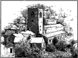
Hanlith
HANLITH, a township in that part of the parish of KIRKBY in MALHAM DALE which is in the western division of the wapentake of STAINCLIFPE and EWCROSS, West riding of the county of YORK, 6 miles (E. S. E:) from Settle, containing 46 inhabitants.
Samuel Lewis “Topographical Dictionary of England” 1831
Please note:
Many duplicate pages relating to general historical detail of Malhamdale which were present under ‘Hanlith’ in the original Kirkbymalhamdale.info, website have been stripped out for the WordPress version due to excessive duplication. Please browse the ‘Malhamdale in General’ section of the site. Please also note that due to close proximity, many Hanlith details may be found within the Kirkby Malham section.
| Maps & Topography | |
| Hanlith hamlet Google Maps view 2024: showing layout of buildings on the hillside. Jefferys’ map : 1771 – 1 inch to 1 mile 1st series Ordnance Survey map : circa 1853 – 6 inch to the mile1907 Ordnance Survey map Modern OS map
Hanlith Houses Map 2016, Ordnance Survey, however may be errors and omissions, |
|
| People & Families | |
| Census 1841 census : Hanlith HO107/1321/02 fo.3 1851 census : Hanlith HO107/2277 fo.475-6 1861 census : Hanlith RG9 / 3180 fo.19-20 1871 census : Hanlith RG10/4257 fo. 18 1881 census : Hanlith RG11 / 4300 fo.16 1891 census : Hanlith RG12/3495 fo.15 1901 census : Hanlith RG13/4023/15
GENUKI Data : An alphabetical list of Malhamdale residents
|
|
| Parish Records Parish Record Index 1597-1813 : Searchable index to the Kirkby Malham parish records created from the Cookson Index, IGI and the 18th century Bishop’s Transcripts, providing a useful finding aid and the most comprehensive set of data available for the 18th century, whose registers were stolen. Kirkby Malham Marriages 1754-1910 : A searchable database transcribed from the marriage registers for St Michael the Archangel. |
|
| Land, Tax, Probate etc. Manorial Rental : Listing Malhamdale tenants and rents in the 14th century. Manor Court Roll 1554: Proceeedings of the manor courts for Hanlith and Kirkby Malham.& links to other dates1640 Lambert Deed – (Calton Moor Highway) : John Lambert of Calton Hall grants to right to Hanlith yeomen to carry coal across his Calton Moor property. Land Tax Assessment 1798 : Listing landowners and occupiers
|
|
| Genealogy & Biography Serjeantson Genealogy : One name study run by Meyricke Serjeantson, with an online family tree and downloadable GEDCOM file. The Serjeantsons of Hanlith : by Rev RM Serjeantson. Privately published family history circa 1911. You can download a PDF of this book from the Family History Archives , select Printing Version from the LH menu bar. |
|
| Buildings & Places | |
| Hanlith Hall: Short history of the building.
Hanlith Hall Gardens https://www.parksandgardens.org/places/hanlith-hall Please copy directly into a new tab in your web browser. : Details from the Parks & Gardens data Service. : Belonged to the Hanlith estate and is often referred to as Hanlith Mill .
|
|
| Photographs | |
| Other Resources | |
